The IBC 2021 and the Peoria Building Code supplement place stringent performance criteria on earth retention systems, particularly given the city's location along the Illinois River valley. With downtown development pushing deeper into the underlying Pennsylvanian-age shale and loess-mantled bluffs, deep excavation monitoring has evolved from a recommended practice into a non-negotiable component of the permit process. The Illinois State Geological Survey maps the region's bedrock as a complex interbedding of shale, limestone, and sandstone with highly variable overconsolidation ratios, a profile that demands real-time deformation tracking rather than post-facto inspection. Our instrumentation programs integrate inclinometers, tilt sensors, and automated total stations to verify that wall deflections remain within the design envelope throughout the construction sequence.
Seasonal freeze-thaw cycling in Peoria's loess creates deformation patterns that single-season monitoring programs routinely miss.
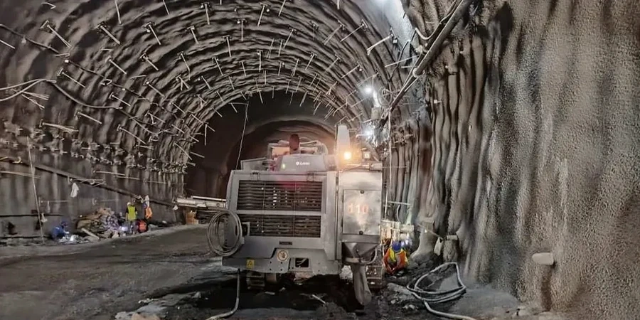
Our approach and scope
Peoria's freeze-thaw cycles introduce a seasonal dimension to excavation behavior that technicians in more temperate climates rarely contend with. From December through February, saturated loess near the cut face can experience ice lensing that temporarily stiffens the soil, only to relax dramatically during the March thaw, producing a distinct spike in lateral displacement readings. This cyclic loading pattern, superimposed on the already challenging contrast between stiff glacial till and weathered shale, means that a monitoring program calibrated during a dry August week may miss critical movement patterns emerging in late winter. We address this by establishing baseline readings across multiple seasonal windows and by deploying vibrating wire piezometers that track pore pressure fluctuations independently of the mechanical deformation data, giving the project engineer a complete picture of the soil mass response as excavation proceeds.
Local geotechnical context
One pattern we observe repeatedly in Peoria is the delayed lateral movement that occurs when excavations intersect perched groundwater lenses within the loess mantle. These lenses, often unmapped during preliminary borings, can saturate the cut face weeks after initial exposure, triggering a gradual creep that goes unnoticed until cracks appear in adjacent pavement or utilities. A properly instrumented monitoring array catches this phenomenon early through incremental inclinometer readings that deviate from the predicted deflection curve. Without this data, the contractor has no objective basis to adjust the bracing sequence or to justify a revised excavation support plan to the reviewing engineer. Given that several downtown blocks sit atop former ravine fills dating to the city's early 20th-century expansion, undocumented fill behavior adds another layer of uncertainty that only continuous monitoring can resolve.
Quick answers
At what depth does the Peoria building code require excavation monitoring?
While the IBC and Peoria amendments do not specify a single trigger depth, monitoring is generally mandated when an excavation exceeds 10 ft vertical or when adjacent structures fall within the zone of influence—typically defined as a horizontal distance equal to 1.5 times the excavation depth from the cut face. Our team reviews the specific site conditions and the structural engineer's deformation criteria to recommend a monitoring scope that satisfies the building official's review requirements.
What is the typical cost range for excavation monitoring services in Peoria?
Programs in the Peoria area generally range from US$820 for a short-term, single-instrument deployment to US$2,520 for a multi-month campaign with automated total stations, inclinometers, and piezometers on a downtown site. The final figure depends on the number of monitoring points, the duration of the excavation sequence, and the reporting frequency required by the project specification.
How quickly are alerts issued if movement exceeds the threshold?
Our automated systems transmit data to a cloud-based platform that processes readings against project-specific thresholds within minutes of acquisition. If a preset deformation or pore pressure limit is exceeded, the engineer of record and the site superintendent receive simultaneous SMS and email notifications, allowing the team to halt work and implement contingency measures before conditions escalate.
Can the monitoring system differentiate between thermal expansion and actual wall movement?
Yes. Temperature compensation is built into our data reduction workflow. We deploy co-located thermistors with all vibrating wire instruments, and for total station networks we apply atmospheric correction models using on-site weather stations. Daily movement reports isolate the structural deformation component, stripping out diurnal thermal cycling effects that can otherwise mask or exaggerate real trends in the Peoria climate.